Boundary Mapping on iOS App
The AgVerdict NEXT App now supports creating boundaries both when online and offline. Users can either draw boundaries manually or use location tracking to map them in real time. The app supports creating and managing both Management and Operational boundaries directly within the platform.
To create a boundary:
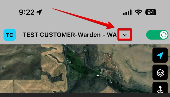
- Select the list drop down next to the growers name.
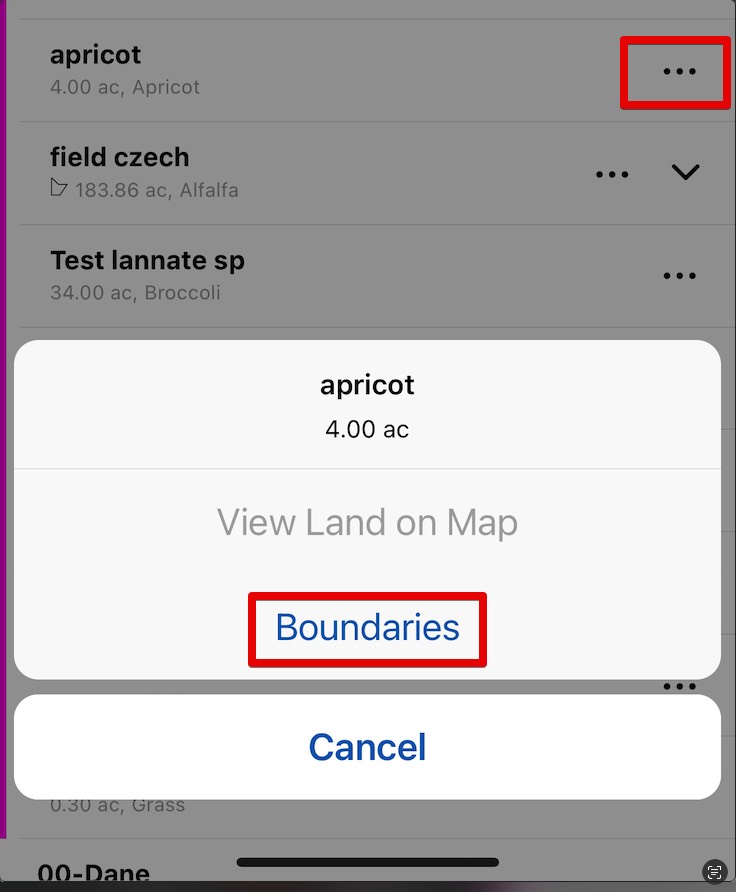
- Select the “…” to the right of the land that you want to create a boundary for, then select “Boundary”.
- If you are editing a boundary follow the prompts. If it’s a new boundary, you can change the name, add a description, and select how you want to create the boundary: Live Tracking, or Draw manually.
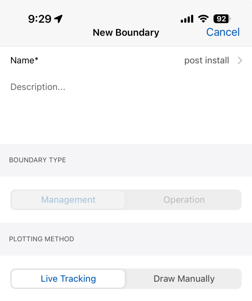
Live Tracking
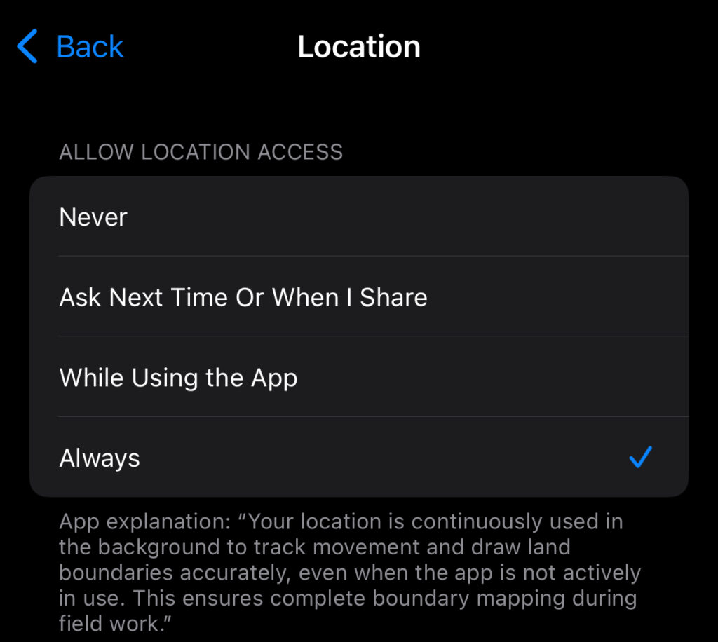
Users can use Live Tracking to have the app create the boundary by walking or driving it.
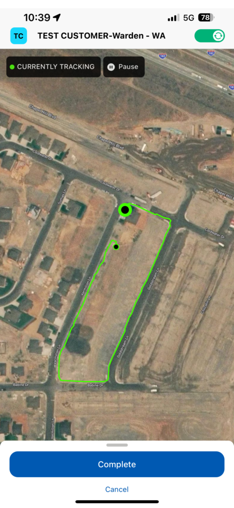
For live tracking to work whe For live tracking to work whether your phone goes to sleep or not, Please set the location services to “Always”.
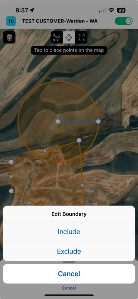
Draw on the Map
Use the tools at the top of the screen to create the boundary. Users can also overlap polygons to add or remove for an existing shape.
- To create a Circle:
- Select the center of the circle first, then the next selection will set the outer boundary.
- For Rectangles:
- The first selection will set one of the corners, then the next will set the opposing corner.
- To Delete:
- Select the Trash Can, then touch the boundary you want to delete.
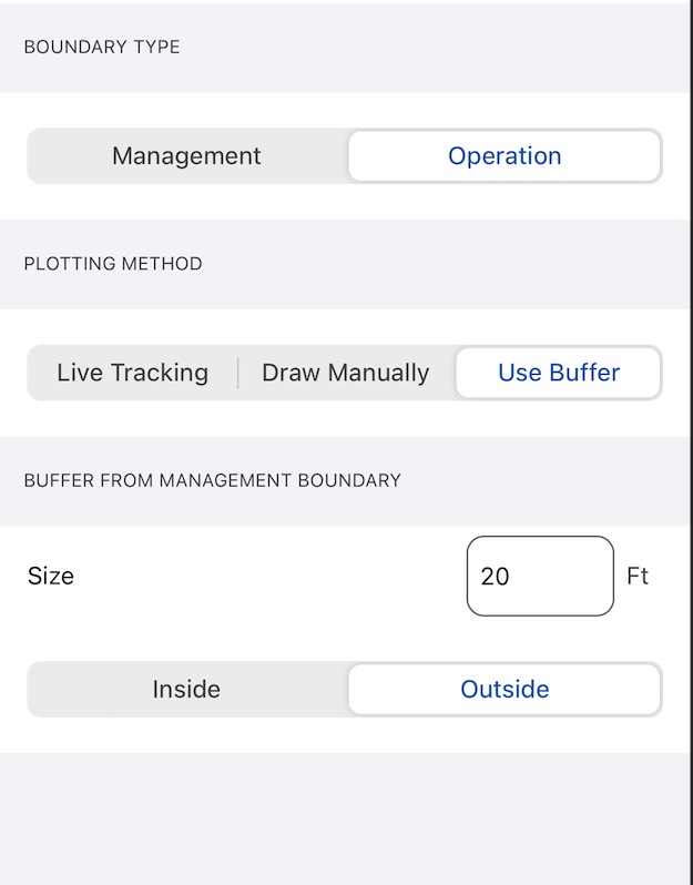
Operational Boundary Buffer
We’ve introduced a new “Buffer” option for operational boundaries in the app. This allows users to offset an operational boundary by a defined number of feet, either inside or outside the corresponding management boundary.
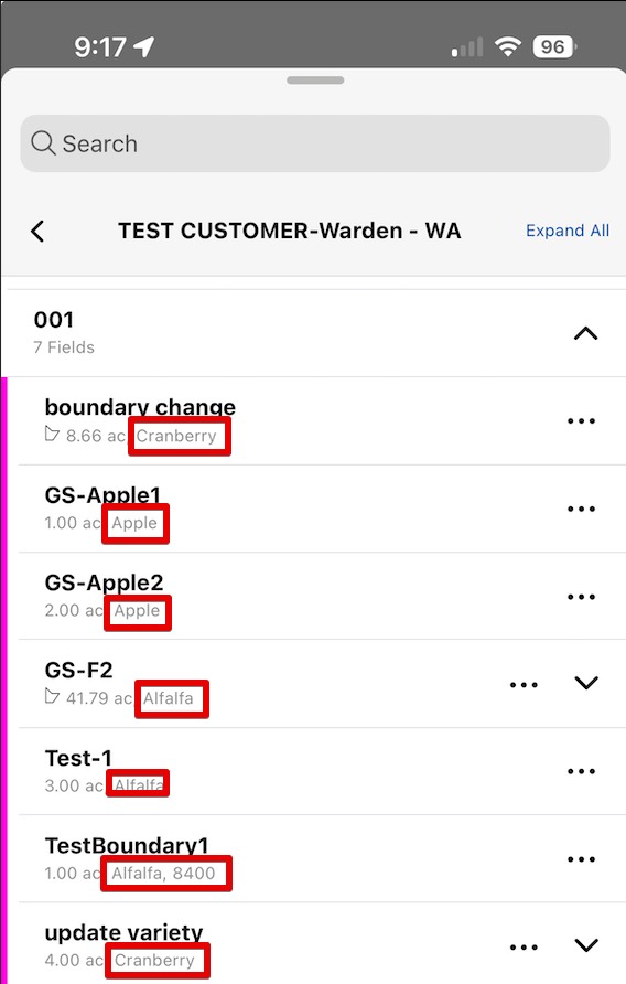
Commodity Details in List View iOS APP
When looking at the G/F/F list on the app, we have added the commodity to that information. This will allow for quick and easy way to know the commodity of the lands.
Web Land Management
Lands can now be marked as “Inactive: in the land details page.
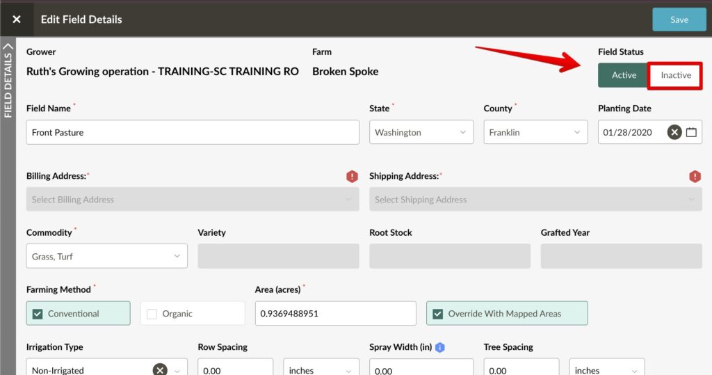
NOTE: To “Reactivate” the land, users can navigate to the “Land Management” feature to turn any land back to Active.
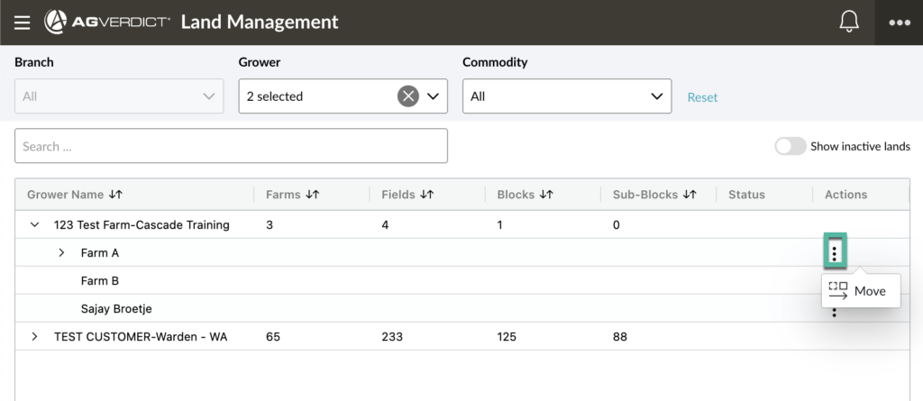
Move Farms
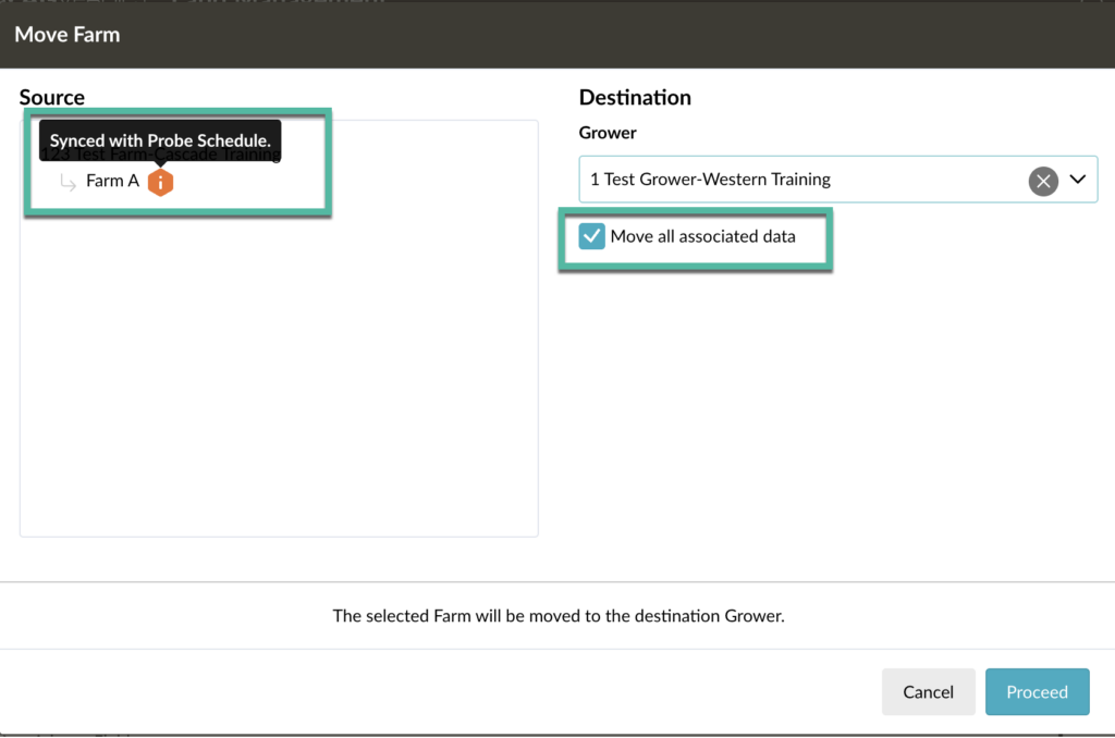
We’ve expanded Land Management to include the ability to move farms, allowing lateral moves across growers, with options to keep or discard related data. When including data, associated recommendations, application events, traps, and scouting notes will also be transferred.
We are also providing a warning tool tip if you try to move a farm that is synced with Probe Schedule to inform the user that they will have to navigate to the new grower in Probe Schedule to view any data.
Other Enhancements
- Updated the “Supervisor report” to match the order of the schedule that is present in the UI. Previously it would order by REC ID, and not user defined order.
- Added “loading” spinner in the Land Management page for when the changes are being completed.